 vesseltracker.com
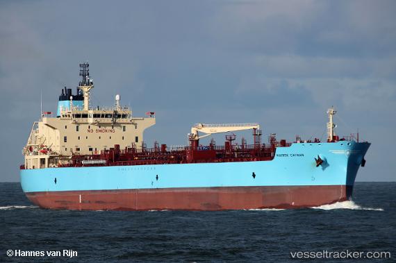
Vessel '219394000' IMO: 9786164, MMSI: 219394000
UTC, 10.01227, 110.64709, course: 222, speed: 12
UTC, 9.83350, 110.45520, course: 224, speed: 11.8
2026-02-21 03:40:53 UTC, 9.47202, 110.10531, course: 222, speed: 13
Live AIS position:
UTC. 104 nm NE of Dai Hung (Tandem Load)),
updated 2026-02-21 03:40:53 UTC.
Find the position of the vessel '219394000' on the map. The latter are known coordinates and path.
marine traffic ship tracker show on live map
The current position of vessel '219394000' is 9.47202 lat / 110.10531 lng. Updated: 2026-02-21 03:40:53 UTCDetails:
Last coordinates of the vessel:
UTC, 10.26103, 110.89577, course: 227, speed: 12.3UTC, 10.01227, 110.64709, course: 222, speed: 12
UTC, 9.83350, 110.45520, course: 224, speed: 11.8
2026-02-21 03:40:53 UTC, 9.47202, 110.10531, course: 222, speed: 13